

fig3
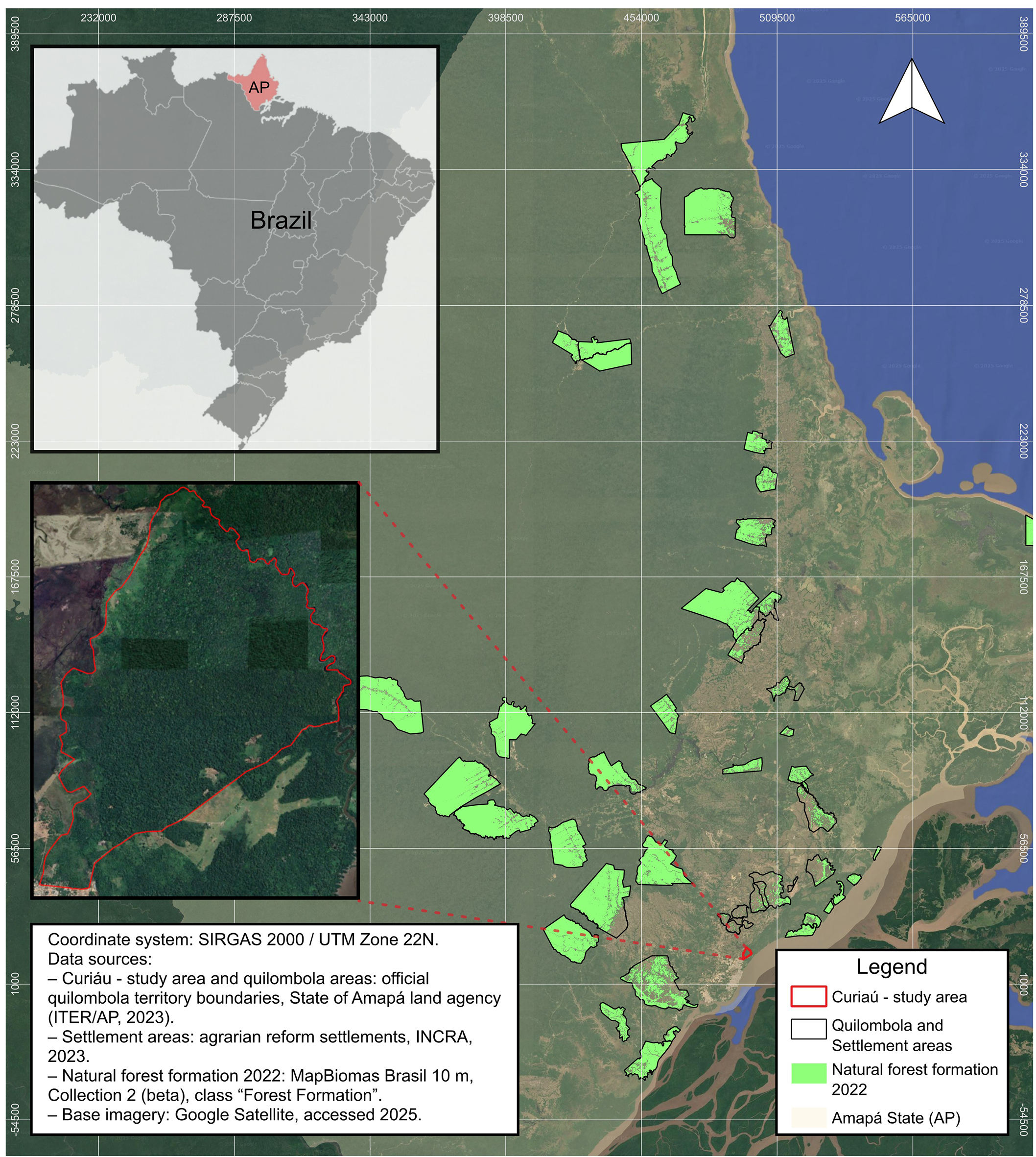
Figure 3. Project area (Curiaú) and reference region, including Quilombola territories and settlements filtered according to SCM0011 robustness criteria, and natural forest formation (2022) used for baseline construction. Data sources: Base imagery from Google Earth (Google Satellite imagery), accessed November 2025 (https://earth.google.com); Land-cover data from MapBiomas Brazil Collection 10 (10 m resolution) (https://brasil.mapbiomas.org); Quilombola territory boundaries from Instituto de Terras do Amapá (ITER-AP); Settlement areas from INCRA - National Institute for Colonization and Agrarian Reform (https://www.gov.br/incra); Map prepared in QGIS v.3.42.1 using the SIRGAS 2000/UTM Zone 22N coordinate system.